
Mt. Kurikoma, autumn foliage routes
- Sep 11, 2024
- 3 min read
Updated: Aug 1, 2025
栗駒山

Mt. Kurikoma (1626m) also known as Mt. Sukawadake in Iwate, is a volcano that borders Iwate, Akita and Miyagi prefectures. It boasts some of the most spectacular autumn foliage in the region and in spring/summer, it's a hot spot for alpine flora and is recognized as one of Japan’s 100 most famous peaks for flowers. It's also home to some of the most acidic onsens in Japan (check out the Sukawa Onsen article).
There are nine routes up this mountain that vary in difficulty and have different starting points. Here are the major ones:
3km 中央コース Chuo Course: beginners and families (2hrs) 4km 東栗駒コース Higashikurikoma Course for beginner to intermediate (2.5hrs)
9km 湯浜コース Yubama Course for the fit (6hrs)
4km 須川コース Sukawa Course for beginners and families (2hrs) *Parts of this course is blocked from Taikatai to the summit. The alternate route toward Ubunuma (産沼) is a little longer and trickier but will get you to the summit! At 苔花台(Taikatai), take the left route rather than the right. Please refer to the map below.
Here we will introduce the Sukawa Course starting from Ichinoseki, Iwate, to catch the autumn foliage which peaks around the Sukawa Kougen Onsen (須川高原温泉) in early October. You'd need to hike a few weeks earlier to see the foliage closer to the summit. For information on how the leaves are looking, please use the Sukawa Visitor Center Instagram for reference: https://www.instagram.com/sukawa_vc/
We parked our car at Sukawa Visitor Center (須川ビジターセンター) and started our ascent from ①須川高原温泉 (sukawakougenonsen) at about 7am. Walk up toward the iconic Daiichi Rock and enjoy the view of the bubbling hot spring.


As you walk up you will see the Sukawa Onsen Shrine. The trail will lead you to a a vast open expanse ② 名残ヶ原 (nagorigahara). In spring, it transforms into a field of cotton grass and in autumn, Japanese pampas grass.


As you go further, you will start to see some amazing landscapes decorated with Kurikoma's signature, multicolored autumn foliage.

*At present (2024), there is a sign that stops you from going towards Lake Sukawa, so please use the left trail that you see here at ③苔花台(Taikitai), and head towards ④産沼 (Ubunuma) to get to the summit. On your way up, you'll have to jump across two streams by hopping on rocks - hiking boots are advisable. The hike is still doable for anyone who has an average fitness level.

The summit! And on a clear day, you will be able to see Mt. Chokai in the distance.
Alternative Route
If you do not have time to get to the summit, this alernative route will lead you to some spectacular, rocky formations and cliff faces.


At ② 名残ヶ原 (nagorigahara) take the alternative route (right at the fork) and follow the trail


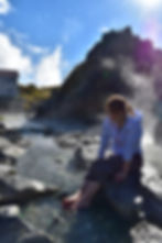
The barren rocks reminded me that I am indeed on top of a volcano. As waves of clouds started to engulf the mountains, it was time to head back.


In the last few years, Mt. Kurikoma has gained a lot of popularity. Hiking from Miyagi Prefecture's Iwakagami Daira route can get very congested during high season. In contrast, the Sukawa Course is less busy, but if at all feasible, I suggest visiting early on a weekday morning. Because of the warmer temperatures over the past few years, the foliage hasn't been the best.
The beautiful Showa Lake (pictured below) must be bypassed due to the present closure, but hopefully in the near future, it'll be safe to trek around again soon.


Access:
From JR Ichinoseki Station take the Iwate-ken Kotsu Bus (Bus stop 9). *Buses are infrequent so do make sure to plan ahead, if unsure double check with the tourism center. English speaking staff are available.
For those planning to go by car park at the visitor center that I have pinned on the map.
For more information about Kurikoma and its seasons, please visit a post I wrote for the Kitakami Times (in this post we make it up to the summit!)-> http://www.iwate-ilc.jp/eng/ktimes/kurikoma-hiking-with-the-seasons/